Introduction:
In the field exercise, we learned about unmanned aerial systems through many hands on activities. We first learned in the classroom about the different UAS platforms that currently exist, and there advantages and disadvantages. Following the classroom portion of the field exercise, we went outside and flew a Phantom UAS while collecting high quality imagery. Lastly, we came back inside to experiment with different software packages, including Mission Planner, RealFlight, and Pix4Dmapper. The field exercise was a great introduction into unmanned aerial systems.
Methods:
Part 1: Classroom learning
At the beginning of the exercise, Dr. Hupy explained what kind of unmanned aerial systems (UAS's) currently existed and thier pros and cons. Two types of UAS's are fixed wing and rotary wing. Fixed wing UAS's have wings than cannot be moved (Figure 1). Rotary wing UAS's have multiple adjustable wings. For example, quadcopter rotary wing UAS's have four wings (Figure 2).
 |
| Figure 1: A fixed wing UAS. http://irevolution.net/2014/05/01/intro-to-humanitarian-uavs/ |
 |
| Figure 2: The quadcopter (above) is a rotary wing UAS. http://best-quadcopter.net/ |
There are multiple pieces of technology that are critical to UAS's, which include the following:
- Pixahak: the "brains" of the UAS
- Modem: communicates between the UAS and ground computer
- Receiver (Rx)
- Battery: usually lithium ion batteries
We learned that there are both benefits and disadvantages for fixed wing and rotary UAS's. Benefits and disadvantages of fixed wing UAS's include:
Benefits:
- long flight time (1.5 hours)
- Fly longer distances than rotary wing UAS
Disadvantages:
- Hard to launch and land; need lots of space and a powerful launching mechanism (sling shot)
- Takes longer than a rotary wing UAS to set up for launch
- Needs more space to turn
- Can be expensive
- Lithium ion batteries are highly explosive when heated (batteries must be kept refrigerated when not in use)
Benefits and disadvantages of rotary wing UAS's include:
Benefits:
- Easy to launch anywhere (straight vertical launch)
- Easy to turn
- Usually more affordable than fixed wing (Phantom = $1,200)
- Six wing has a higher payload capacity than quadcopter
Disadvantages:
- Fly shorter distance than fixed wing UAS
- Shorter flight time
Part 2: Flying the Phantom
During the field exercise, we were given the chance to see a rotary wing UAS in action. Dr. Hupy took the class on the bank of the Chippewa River where we conducted our first two exercises to demonstrate how to fly a Phatom, a rotary wing UAS. A Gimble camera was used to capture high-quality pictures of the Chipppewa River bank. The pictures were later processed in Pix4D to create orthomosaic and hillshade images. The Phantom was controlled with a large, handheld remote. A tablet was attached to the remote, which could control the Gimble camera and the Phantom. The Phantom was flown at an altitude of approximately 25ft (7.6m). Flight conditions were good because it was sunny and the wind was weak. After taking pictures of the bank, Dr. Hupy let students, including me, fly the Phantom. It was a fantastic experience! I learned that it took very small, controlled movement of the toggle sticks to control the Phantom. The system was relatively stable, and had an exceptional ability to hover in place.
While in the field, Dr. Hupy explained the real-life applications of unmanned aerial systems. One application included inspecting the safety of bridges, which would protect the safety of engineers who ususally have to inspect the bridges themselves. Other applications for UAS’s are agricultural monitoring, volumetric analysis of mines, and cave exploration.
 |
| Figure 3: Dr. Hupy instructed the class how to fly the Phantom. He then gave students the opportunity to fly the UAS. |
Part 3: Software
RealFlight
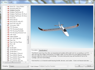
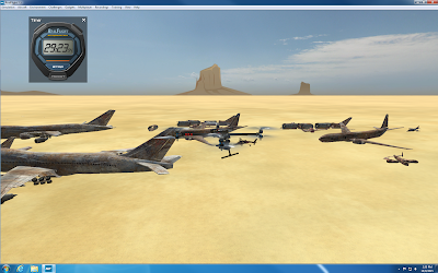
RealFlight is a UAS flight simulation software. Part of the field exercise included completing a flight simulation with a fixed wing system and rotary wing system for 30 minutes each. During the fixed wing flight simulation, I flew a NextSTAR, Multiplex EasyStar, and Predator drone (Figure 4). The simulations taught me that most fixed wing UAS’s are more touchy and faster than rotary wing UAS’s. All of the fixed wing UAS’s I flew were relatively easy to get the hang of. The only system that was cumbersome was the Predator drone, which took a long time to make turns. I learned the rotary wing systems were a lot less touchy than fixed wing systems, but they were a lot slower. Rotary wing systems I flew include a Hexacopter780, QuadcopterX, and X8 Quadcopter (Figure 5). The simulation taught me that rotary wing systems are better for surveying smaller portions of land for high quality imagery, while fixed wing systems are suited for surveying larger portions of land for decent quality imagery.
Mission Planner Software:
Mission Planner is a software used to devise automated missions for UAS’s. Although we did not conduct automated flights, we experimented with the software to see how different camera sensors and altitudes affected each mission. We used the practice track field on the upper campus of UW-Eau Claire as our area of interest. As altitude increased in the mission planner, the number of flight lines decreased, which decreased flight time and the amount of pictures taken (Figures 6 and 7). Another factor that decreased the number of flight lines was increasing the flight line angle. Sensor type did not seem to affect the number of flight lines very much. Altitude and flight angle are critical factors to creating successful missions with your available technology. Most UAS’s have maximum flight times of 1-1.5 hours, which means missions must be planned accordingly in advance. Although most of the planned missions for the track field were under five minutes, flight time is still important. For example, flight time is very important when planning missions that involve surveying large amounts of land. Overall, the Mission Planner software is a useful tool for creating successful UAS missions.
Pix4Dmapper
 |
| Figure 4: The Multiplex EasyStar was one of the fixed wing systems I flew in the simulation. |
 |
| Figure 5: The X8 Quadcopter was a rotary wing UAS I flew in the simulation. |
Mission Planner Software:
Mission Planner is a software used to devise automated missions for UAS’s. Although we did not conduct automated flights, we experimented with the software to see how different camera sensors and altitudes affected each mission. We used the practice track field on the upper campus of UW-Eau Claire as our area of interest. As altitude increased in the mission planner, the number of flight lines decreased, which decreased flight time and the amount of pictures taken (Figures 6 and 7). Another factor that decreased the number of flight lines was increasing the flight line angle. Sensor type did not seem to affect the number of flight lines very much. Altitude and flight angle are critical factors to creating successful missions with your available technology. Most UAS’s have maximum flight times of 1-1.5 hours, which means missions must be planned accordingly in advance. Although most of the planned missions for the track field were under five minutes, flight time is still important. For example, flight time is very important when planning missions that involve surveying large amounts of land. Overall, the Mission Planner software is a useful tool for creating successful UAS missions.
 |
| Figure 6: The Mission Planner is set at an altitue of 25m with a 0° flight line angle. |
 |
| Figure 7: The altitude was increaded to 55m, which decreased the number of fligh lines and mission time. |
Pix4Dmapper
The Pix4Dmapper software was used to process the imagery collected with the Phantom in the field with Dr. Hupy. Processing created an orthomosaic image and a digital surface model (DSM), which were both brought into ArcMap 10.3.1 to create maps of the surveyed area. The orthomosaic image demonstrates the high quality data the Phantom is capable of capturing (Figure 8), while the hillshade shows how the Phantom can be used to collect elevation information of surveyed surfaces (Figure 9). Metadata for the orthomosaic image can be seen in Figure 10.
 |
| Figure 8: The orthomosaic image collected, generated in Pix4D using data collected by the Phantom, shows a surface feature created by students on the bank of the Chippewa River. |
 |
| Figure 9: The hillshade of the river bank shows elevation data. |
 |
| Figure 10: Metadata for the orthomosaic image created using a Phantom UAS, Pix4D, and ArcMap 10.3.1. |
Discussion:
In the field exercise, a client theoretically contacted me to ask how UAS could be used to find where crops were unhealthy on an 8,000 acre pinapple plantaion. Additionally, the client wanted to use UAS to determine when would be the best time to harvest.
Based on the client's needs, I would recomend using a fixed wing UAS with a high quality camera and near-infraraed sensor. Although 8,000 acres could not be economically surveyed by one UAS in a week, multiple fields could be surveyed once a week with a fixed wing UAS. PrecisionHawk's Lancaster is one fixed wing UAS the client could use (Figure 11). The Lancaster has a maximum flight time of 1 hour, and costs roughly $25,000 (DRONELIFE.com, 2014). Other UAS options can be found at http://dronelife.com/2014/10/01/best-agricultural-drones-available-today/. Pictures collected from a high quality camera, like a Gimble, could be used to monitor conditions of the crops, like canopy coverage, moisture, and bug problems. A near-infrared sensor could be used to collect near-infrared imagery, which would show cloporphyll levels in the pineapple trees. Chrolophyll levels are a direct indication of plant health, and can show where crops are stressed (Tenkabaail P.S. and Lyon J.G., 2011). Such information could then be applied to adjust agricultural practices.
 |
| Figure 11: PrecisionHawk's Lancaster Hawkeye Mark III is well suited for agricultural monitoring: http://dronelife.com/cms/product/Lancaster-Hawkeye-Mark-III |
Another recommended option would be to use LANDSAT 8 satelittle imagery to collect near-infrared imagery for all 8,000 acres. The imagery could be collected every 16 days, or just about every two weeks (United States Geological Survey, 2015). During a regular week, a fixed wing UAS could be used to collect imagery from specific fields, and every two weeks LANDSAT 8 data could be used to monitor the health of the entire plantation. LANDSAT 8 data can be downloaded for free using the information at the following link: http://glovis.usgs.gov/QuickStart.shtml.
To determine the best time to harvest on the pineapple plantation, the Gimble camera and near-infrared sensor could be used to collect weekly data. LANDSAT 8 data collected biweekly would also prove useful. This concludes the client evaluation report.
Conclusion:
Overall, the field exercise helped me learn about the different types of unmanned aerial systems that exist today and their potential applications. I gained hands on experience flying a rotary wing UAS, planning UAS automated flight missions, practicing UAS flying with flight simulation software, and processing imagery collected by a UAS. Unmanned aerial systems have many potential applications, and knowledge of UAS’s will prove to be useful in my future career.
Works Cited:
DRONELIFE.com. (2014). "Lancaster Hawkeye Mark III". Retrieved from: http://dronelife.com/cms/product/Lancaster-Hawkeye-Mark-III
Tenkabaail P.S. and Lyon J.G. (2011). "Hyperspectral Remote Sensing of Vegetation". Retrieved from: https://books.google.com/books?id=B0LNBQAAQBAJ&pg=PA4&lpg=PA4&dq=measuring+chlorophyll+levels+in+plants+in+agriculture&source=bl&ots=93tmw9XO5E&sig=3Y09s51mwiJhebSAY6IIOl2wNrg&hl=en&sa=X&ved=0CEoQ6AEwB2oVChMIlcb79866yAIVBM-ACh2LrQXc#v=onepage&q=measuring%20chlorophyll%20levels%20in%20plants%20in%20agriculture&f=false
United States Geological Survey. (2015). "LANDSAT 8". Retrieved from: http://landsat.usgs.gov/landsat8.php
No comments:
Post a Comment